

Shout-out to the Craigleith Heritage Depot! We are proud to share these insights courtesy of their incredible archives. The Depot is an essential guardian of the unique stories and ecosystems that make our watershed so special. Check out their collections to see more of our shared heritage!
The Sculpted Legacy of the Beaver River
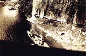
The Beaver Valley tells a remarkable story of geological power and ecological resilience. From the massive ice sheets of the last glacial period to the rhythmic flow of the modern river, this landscape is a living museum of natural history.
[A black and white photograph of two people canoeing down the Beaver River at Heathcote. Credit: Craigleith Heritage Depot]
Ancient Foundations: The Work of Glaciers
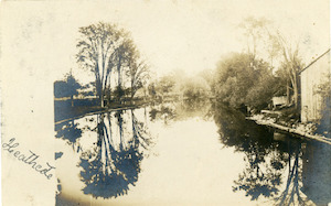
The valley’s distinctive “flat floor” is a gift from the Ice Age. As glaciers retreated thousands of years ago, they paused north of Heathcote, leaving behind a moraine—a massive ridge of rock and soil debris. This ridge acted as a natural dam, creating a deep, ancient lake.
[A postcard showing the Beaver River at Heathcote. Irene sent it to Miss Lucy White of Collingwood. The message includes thanks for a previous card which the sender received. The card was likely sent around Christmas c.1880s-1900s. Credit: Craigleith Heritage Depot]
Over time, this lake receded, leaving behind a level valley floor composed of rich, fertile sediment. Today, travelers can still see the “steps” of history:
- The Moraine: A testament to the glacier’s stationary power.
- Glacial Beaches: Remnants of Lake Algonquin, visible as distinct levels in the landscape between Heathcote and Clarksburg.
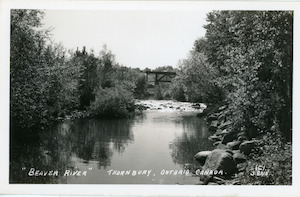
[Black and white photographic print of a portion of the Beaver River that runs through Thornbury. Credit: Craigleith Heritage Depot]
The River as Sculptor
The Beaver River is a dynamic force that continues to reshape the valley daily. As it winds from Kimberley to the shores of Georgian Bay, it displays a variety of classic river features:
- Meanders & Point Bars: The river curves in graceful bends, depositing sand and gravel on the inner curves to form point bars.
- Riffles & Pools: The ecosystem relies on the alternating rhythm of shallow, fast-moving water (riffles) and deep, quiet areas (pools).
- The Final Descent: Before emptying into Georgian Bay, the river carves a narrow path reaching depths of 23 meters, eventually crossing an ancient delta that signals the end of its long journey.
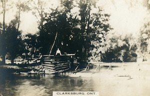
[Black and white photographic print of two people standing near a log structure on Beaver River in Clarksburg. Credit: Craigleith Heritage Depot]
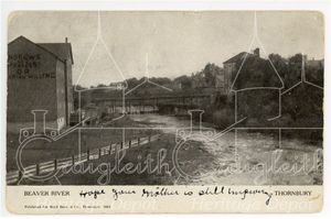
[A black and white postcard showing the Beaver River, Andrews Flour Mill, the foot bridge, and Thornbury Dam in the background.
The handwritten message on the postcard reads, “Hope your mother is still improving.”
The printed text on the postcard reads, “Beaver River, Thornbury, Printed for Boyd Bros. and Co. Thornbury.” Credit: Craigleith Heritage Depot]
The Fertile Floodplain
The heart of the valley is its floodplain. While seasonal flooding is often viewed as a challenge, it is the primary source of the valley’s biological wealth. Each flood leaves behind layers of fine silt and sand, creating a nutrient-dense environment for unique flora:
- Ancient Lagoons: The floodplain still holds the remnants of post-glacial lagoons, creating specialized habitats that support a high degree of biodiversity.
- Moisture-Loving Species: Ostrich ferns, red canary grass, and common elderberries thrive in this damp, rich soil.
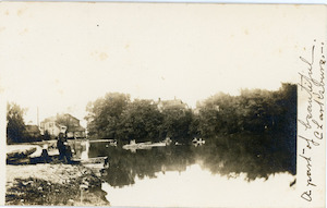
[A postcard with a black and white photo of someone standing at the edge of a body of water in Clarksburg. The card was sent to Mr. G.G. Abbery of Meaford. Credit: Craigleith Heritage Depot]
A Sanctuary for Biodiversity
Thanks to the variety of terrain—from dense forests to open wetlands, the Beaver Valley serves as a vital sanctuary for wildlife.
- Avian Haven: The river provides hunting grounds for Great Egrets. Nearby Nottawasaga Island is particularly significant, hosting the most northerly nesting colony of Great Blue Herons in North America since 1985.
- Towering Flora: The silt-rich soil between Kimberley and Heathcote supports massive forest growth, including rare sights like climbing poison ivy that reach impressive heights into the canopy.
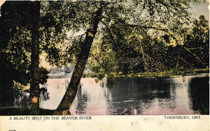
[The image is of a postcard that was sent to Mrs. Thos. Mc Callum of Inglewood, ON by someone named Laura. The front of the card shows an image of the Beaver River dated August 17, 1916. Credit: Craigleith Heritage Depot]
Whether viewed from a kayak or a hiking trail, the Beaver Valley remains a profound example of how water and ice can collaborate to create a thriving, ever-changing home for nature.
Related posts:
 Throwback to the Beaver River Rat Race
 Managing Stormwater as a Watershed Resource
 Damselflies and Dragonflies of the Beaver River
 Fly Fishing on the River
 The Wickens Family in Kimberley, 1857 and on
 Growing a Resilient Future Using Local Seeds
 Late Winter/Early Spring birds
 Local Tree Trust Spotlights Four Old Maples
 Eugenia Historic Walking Tour
 E. C. Carr Observatory