
Submitted by Stacie Howe
The day might also fondly be described as “searching for piles of rocks and mud” which is actually very exciting when tagging along with a geologist — Beth Gilhespy — and a naturalist — Bob Bowles.
Beth was in her element as we drove up and down both sides of the Valley several times, identifying the layers of bedrock, from the red Queenston Shale at the bottom, up into the terraces of Manitoulin Dolostone, then the Cabot Head Shale where springs emerge, and topped with the Fossil Hill Dolostone and the beautiful Manitoulin Dolostone. (You can get a re-fresher in Geology of the Beaver Valley.)
Moraines — debris left behind by glaciers — sit on top of our bedrock in a distinct pattern as the glacier that filled the Beaver Valley 10,000 years ago spilled its rubble and sand along the edges of the escarpment.
There are two distinct moraines in our watershed: the Banks Moraine and the Gibralter Moraine, named for small towns where they were first studied. The Gibralter Moraine was created first and is further south. The Banks Moraine was created at a later time, in a separate push of glacial action.
Our first stop was at Eugenia Falls for an excellent sighting of the Gibralter Moraine. The sloping hill on the west side at the top of the falls is clearly visible on top of the bedrock shelf that the water is rushing over.
You may have heard about the tunnel that was constructed in 1907 to divert the river at Eugenia Falls in order to build a dam and create a power station. This tunnel was not excavated through solid limestone, but instead through the glacial moraine sitting on top of the Amabel Dolostone, a much easier dig than bedrock.
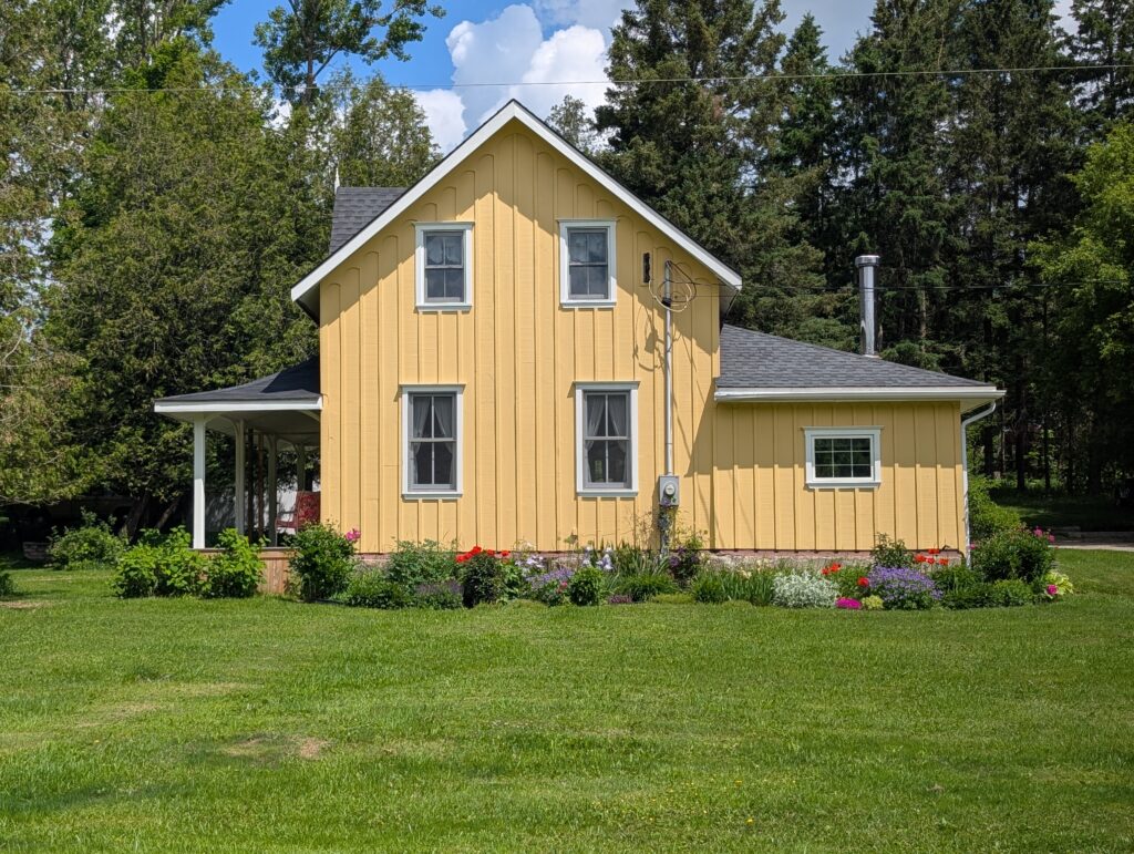
On our way to the next stop, we passed the original Bowles family homestead, at the top of Bowles Hill.
Bob spent his childhood in this house, and has fond memories of the pond across the road, the sinkhole his mother warned him about playing near, and the view from his bedroom window.
A deer crossed our path as we admired the house. Bob’s brother and sister still live on the neighbouring properties, once part of the original property.
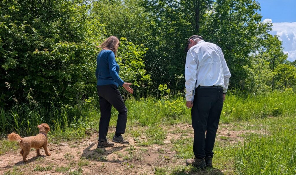
Continuing north into the Beaver Valley Ski Club and the Kimberley Forest, we hiked along a trail that follows the top of a moraine, which shows up as higher areas on topoographical maps. The moraine itself is only 500 m wide, but it stretches in length all the way to Griersville before curving to the west.
Beth is stretching her arms in this photo to show how the morine is dropping away on both sides of the trail.
The warm sandy rise of land was also being enjoyed by a common wood-nymph and a little wood-satyr (both butterflies) as well as a common whitetail skimmer (a dragonfly).
This moraine blocks Wodehouse Creek so that the water flows south for a ways before spilling over the escarpment. Bob remembers the creek being called “Blind Creek”. There was no water in it today — it’s fed by the Wodehouse Karst area, which both floods and drains quickly due to the special topography.