
Osprey Township Car Tour Touring Time—including stops—is approximately three hours. The starting point is Osprey Museum (former Salvation Army Church), 315 Mill Bridge Road (at Wellington street), in Feversham.

GENERAL INSTRUCTIONS
- Read all instructions before starting your tour.
- For safety reasons, there must be a navigator to get the driver through the tour instructions. We consider it as highly unsafe for the driver to assume the task of navigating.
- This is not a race – it is an adventure into the past. Have fun and drive safely.
- All questions should be answered without entering any properties.
- Follow the instructions as best as you can. Should you get lost, go back to where you know you were right and try again. Remember to adjust the KM.
- At times, you will be asked questions; fill in the answers as best as you can.
- Driver: keep your eyes on the road – you have a navigator to get you around.
- We have provided historical information on the sites to the best of our knowledge. If you have additional information, please let us know.
DISCLAIMER
The organizers do not guarantee that the instructions are error free, nor that all the roads will be available the day of the tour (i.e. construction detours or closures). The route was tested. You may have to use your skills and get around any construction detours and connect back with the map.
FEVERSHAM
The Pioneer Settlement of Feversham was founded during the 1850s by Edward Horton; it was originally called “Hungry Hollow”. The name of Feversham refers to Lord Feversham of Feversham, England. By 1866 Feversham was a thriving small town with a gristmill, an oatmeal mill, a sawmill, a Post Office, 2 stores, a school, 2 frame churches, a tavern and a cabinet maker.
Osprey Museum—Feversham (former Salvation Army Church) – Con 9 pt lot 16&17 (315 Mill Bridge Rd)
Originally a hotel owned by John McCormick was located on this site. In 1901 this building burned down and the lot was purchased by Mrs. Thomas Poole. A Salvation Army Church was erected in 1903 and served the community until March 1995. The building was then donated to Osprey Museum.
Straight west on Wellington Road to Stop Sign and turn right into Mill Bridge Road
Straight ahead, (North) on Mill Bridge Rd. to top of Hill 0.2 k
Burns Presbyterian Church and Cemetery at the top of Hill
Burns Presbyterian Church and Cemetery – Con 9 pt lot 16 (104 Peel St.)
Edward Horton, the founder of Feversham, donated 2 acres of land for a Presbyterian Church. In 1862 several local families were responsible for building the wood frame Church. They named it for Robert Burns of Knox College.
Questions:
1. Which little girl is remembered on two head stones? (Both head stones are in the same location, one in front of the other)
2. What is the most recent improvement to the front of the Church?
Turn around in Parking Lot and drive back same route
Hillside House at # 338 is an original settler residence
“Hillside House”
It was built around 1900. It is a red brick, cottage shaped, single storey box structure. Characteristic design features are the rows of white bricks at the top under the eaves and at the bottom just over the foundation. The sturdy front porch gives the hillside house a welcoming appearance.
Travel to the Church of the Nazarene
Church of Nazarene – Con 9 pt lot 16 (334 Mill Bridge Rd)
This cement block church was built in 1924 and opened for services in 1925. The congregation was known as the Gospel Workers and the name changed to the Church of Nazarene in the 1940s.
Stop at River Road and straight ahead
The Flour, Oat and Saw Mill
Edward Horton built the grist mill in the early 1860’s. After his death in 1864 the mill was sold to Arthur McRoberts. Later the property passed from private ownership to co-operative ownership and was then run by local farmers who held shares. The frame grist mill burned completely in December 1904. The mill was rebuilt in 1905 as a stone structure and re-opened for business. Disaster stroke again in 1978 and the mill was destroyed by fire. The large metal shed now standing at the location of the former Grist Mill does not contain milling equipment.
Straight ahead and cross Wellington Street;
Turn right into John Street
You will pass the Old Methodist cemetery on your right
Feversham Old Methodist Cemetery – located in Con 9 Lot 16
Edward Horton, the founder of Feversham, is buried in this cemetery. He was born 1812 and died Jan. 16, 1864. A little log church existed for a number of years but was later abandoned. We were unable to locate any descendants of the Horton Family in the immediate area. Horton’s two sons moved to Western Canada after his death.
Question:
1. Most of the head stones remember children. What is the age of the oldest person whose head stone still exists at the cemetery?
Stop at Grey Road # 2 and turn right
Turn right into River Road (back into Feversham)
Feversham School – S.S. #7 – 115 River Road
Edward Horton set aside free land for the first school in Feversham. The first frame school was built near the north- east corner of Victoria Street and 15th Sideroad, and opened November 1853. Later the building was moved to the opposite side of the road. In 1896 this school was closed and a new red brick school was constructed on the origi- nal site of the first frame school. By 1928 all grades to Grade 12 were taught. The school closed in 1965 and later became the New Horizons Nursing Home, a special care facility for children with severe disabilities, which operated until 1979. The school was restored to a private home in 1999.
Question:
1. What is the Fire # of the Old Feversham School House?
Drive straight to Stop Sign
The General Store – NE corner of River Road & Mill Bridge Road (137 River Rd.)
This store has existed as a General Store and Post Office for close to a century. The mural on the west wall was added recently and depicts the grist mill which once existed in Feversham.
Straight ahead on River Road to Stop Sign & 10th Concession
Turn left into 10th Concession & drive to next Stop Sign
Cross Grey Road 2 and straight ahead on 10th Concession
Red Brick House – Conc. 10, west of Grey Rd 2; Conc. 10, Lot 14 (448144 Road 41B)
The property was received from the crown by Henry Hudson in 1873. The house was built late 1800s or early 1900s and stayed in the Hudson Family until 1908. One more recent owner was a film writer/maker for David Suzuki.
Questions:
1. What is the name of the Cemetery?
2. At what tender age did Charles die on November 4, 1871?
The first recorded burial in this cemetery is that of William Weldrick in 1859.
Red Brick House – Conc. 10, west of SR 45; Conc. 10 Lot 10 (447606 Conc. 10)
The original settler of this property was D. Colquet, who received the land in 1873. It stayed in the family at least in part until 1911. The house was built around the turn of the century. Originally it was entirely symmetrical when viewed from the front. This feature makes it different from the usual farmhouses of Grey County that are entirely non-symmetrical. Also, the slightly protruding two storey square bay is a feature normally not seen at houses of that era.
Straight ahead to Side Road 41B
Turn left into Side Road 41B
Questions:
1. What is the fire number of the old School on the left?
2. What essential fixture is displayed on the lawn?
Sideroad School—S.S. #5; Sideroad 41B east side, south of Conc. 10 road; Conc. 10 Lot 6 (414367 Road 41B)
A wooden frame school was built around 1874 and served until 1914 when the present brick school was built on the same site. It was used until 1965 and is now a private residence.
Straight ahead to Concession #8 and Stop
Left turn into Concession #8
Straight ahead to SideRoad #45
Turn right into SideRoad #45
Straight ahead to Stop Sign @ Hwy # 4
MAXWELL
Maxwell was founded around 1860 and was originally called Charleston. It grew into a larger commercial centre as it was in a central location between Durham and Collingwood. By 1880 it had a population of more than 200with 2 stores, 2 hotels, 2 blacksmith shops, 3 carriage makers, one shoemaker and one tailor. By 1906 it had 4 churches, an Orange Hall, a Lodge of Forresters, three stores and a doctor. The building on your right-hand side is the old Orange Hall.
Straight ahead on Grey Road 2
Questions:
1. Can you guess what the original building at the south/east corner of Grey Roads 4 & 2 was?
2. What is the present name of the former Church on your left-hand side?
Maxwell Union Cemetery – Grey Rd 2, South of Grey rd 4 (453966 Grey Rd. 2)
This cemetery has no sign.
Question:
1. What is the Fire # of the former Maxwell School House next to the Union Cemetery?
Maxwell School—S.S. #9 – Conc. 6, Lot 10; Grey Rd 2, South of Grey Rd 4 (453964 Grey Rd. 2)
Osprey School Section 9 was established in 1861. The first school was built on a lot next to the one where the Church of England now stands. In 1865 a fire destroyed the building. The new school was built on its present location. The building was wired for electrical lights in 1948. The school closed in 1965 and is now a private residence.
Straight to Concession 4B
Left turn into Concession 4B
Straight to Side Road 55
Turn right into Side Road 55
Question:
1. When was this school built?
Red Brick School—S.S.#3 – Pt Lot 21, Conc. 3; Side Rd 55 South of Conc. 4B (553763 Road 55)
The school was built by local craftsmen in 1884. The enrolment was usually about 83 students. The school closed in 1965 and is now a private residence.
Straight ahead to Concession #3
Stop and Turn right into Concession #3
Straight to next Intersection – Hatherton
HATHERTON
The Pioneer Settlement of Hatherton received its name from the government employee who set up the post office > He was from Ireland. The Orange Hall was built in the late 1800s, serving as community centre and church.
Question:
1. What is the fire # of the Old School House?
Hatherton School—S.S.#11 – SW corner of Conc. 3 & Side Rd 49 (328206 3rd Concession)
The school was built in 1904. A few years later the walls of the school needed support and cement piers were in- stalled. In 1965 the school was closed and is now a private residence.
Questions:
1. What is the Chapter number on the old Orange Hall?
2. How many standing head stones are on the Hatherton Cemetery?
Hatherton Cemetery – Conc. 3, East of Grey Rd 2, Conc. 3 Lot 15:
William Hicks donated the land for this cemetery which was located across from the Orange Hall in Hatherton. It was abandoned around 1900.
Straight to County Road 2 – Stop & continue straight
Straight to Side Road 41A and right turn onto 41A
Stop, left turn onto Concession 4B
Straight on Concession 4B to Osprey-Artemesia Townline
Question:
1. Over how many creeks did you drive on this stretch of Concession 4B?
Turn right into Osprey-Artemesia Townline
Questions:
1. What are the ornaments on the lawn at Fire # 353938?
2. And what could you sleep on?
Stop at Grey Road 4
The Cobblestone House – Conc. 6 Lot 1 (located on your right hand side)
Tucker Phillips built a rough frame house on this property which was replaced around 1900 with the present cob- blestone house. This cobblestone technique is mainly found around the town of Paris. It appears to be the only building of this style in Grey Highlands.
Straight across – continue on Artemesia Townline to Conc. # 8
Question:
1. Which river are you crossing?
Stop – continue straight ahead along Osprey-Artemesia Townline
Question:
1. What type of vehicles can use this road during the winter?
Stop at Concession #10
Straight across Concession #10 and continue on Osprey-Artemesia Townline
Rock Hill Community Pioneer Cemetery – 354428 Osprey-Artemesia Townline
This cemetery is located on the Artemesia side of the Osprey-Artemesia Townline at the NW corner of Osprey Conc. 10 and the Townline.
Questions:
1. At what part of their lives were most of the interred at the Rock Hill Pioneer Cemetery (elderly, adults,children)?
2. How many bridges do you see at your left?
Straight ahead on Osprey Artemesia Townline to Concession # 12B
Right turn into Concession # 12B
Question:
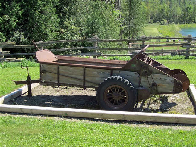
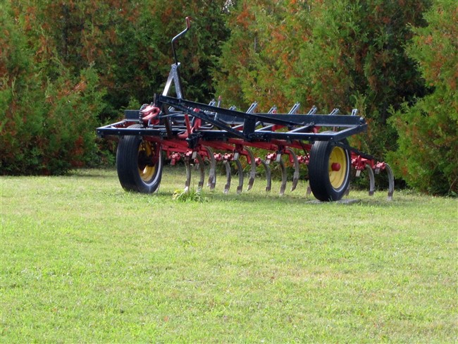
1. What kind of implement is in front of “The Lodge”?
Straight to Side Road # 41B
LADY BANK
The Pioneer Settlement of Lady Bank was a small settlement with a Post Office and a school, but no store. A church was erected by 1903. Neither the school nor the church or post office remain.
Providence Cemetery — Conc. 12 Lot 6 (SE corner of #12B and #41B)
The first settlers came to the 12th concession in 1853. The first school was erected in 1850 on Lot 10 in 1850, Con- cession 12. The Tom Poole family was among the earliest arrivals. Providence church was located on the property belonging to Josiah Crawford on the S. E. corner of Lady Bank. A church was not erected until 1903 although ser- vices had been held there since the 1850s. The cemetery was situated west of the church.
Questions:
1. What other colours than grey are the head stones?
2. Whose daughter was Sarah Ottewell?
Straight ahead to Side Road # 45
Left hand turn onto Side Road # 45
Stop at Osprey-Blue Mountains Townline and turn right
Straight to Grey Road # 2 and Stop
Turn right onto Grey Road # 2
Straight ahead to Grey Road # 31
Question:
1. Which Municipality welcomes you?
Turn left onto Grey Road # 31
Question:
1. With whom should motorists share the road?
You will approach the Pioneer Settlement of Buckingham
BUCKINGHAM
Pioneer Settlement of Buckingham consisted of the church and a cemetery, both located on land donated by John Buckingham, who the settlement was named after. The original church was of log construction and was thought to be the first church in the northern part of Osprey. Later a log store was established during the 1850s.
Buckingham Methodist Church and Cemetery
In the 1850s Mr. John Buckingham donated a plot of land for this church and cemetery. A log church was built. The present brick church was built in 1891 and served the community for 60 years. The last service was held in 1952.
Questions:
1. When was the Methodist Church built?
2. How are the families Buckingham and Osborne related?
Straight ahead to Side Road # 55
Turn left onto Side Road # 55
Straight on # 55 to Osprey-Blue Mountain Townline
Stop at Osprey-Blue Mountain Townline
Maple Grove Baptist Church – Collingwood Township (now Town of Blue Mountains)
This church is located at the NE corner of Osprey Side Road 55 and the Blue Mountains-Osprey Townline. It was built in 1908 and served the Osprey and Collingwood Townships until 1959. The building was sold in 1972 and is now a private residence.
Right hand turn onto Osprey-Blue Mountain Townline
Question:
1. Which forest is at the north of the Townline?
Straight along Osprey-Blue Mountain Townline and Reid’s Hill Rd. to Pretty River Road 60.
Tee Right onto Pretty River Road
Stop and turn left onto Grey Road 31
Enter Parking Lot of Zion Church
ROB ROY
Rob Roy United Church – Conc. 13 Lot 32 (469487 Grey Rd. 31)
This church was built 1877 at “Bristow’s Hill”. The property was obtained from Gilbert and Sarah Morrison Currie. Until that time church services were held in private homes.
Question:
1. Which name is on the musical gravestone?
Turn around in parking lot Turn right onto Grey Road 31
Stop at Pretty River Road
You have reached the Pioneer Settlement of Rob Roy and are at the parking lot of the Old School House.
Rob Roy School S.S. #10 – 634632 Pretty River Road
The first school was a log building on lot 30 Concession 12 and served the community from 1860 to 1880. A new school was built in 1880 on Lot 30 Concession 13 and had an enrolment of about 80 pupils. This building burned down in the Spring of 1889 and was replaced by the present brick school in the fall of the same year. The school closed its doors in 1965 and was used as a community meeting hall. In 1992, it became the Osprey Museum.
Go 4.3 km south from Rob Roy on Road 63
BREWSTER’S LAKE
Evangelical Missionary Church – 634199 Rd. 63
At Brewster’s Lake, this church was formerly known as the Mount Pleasant Missionary Church. In 1899, three years after the denomination began when Mrs. Henry Sprott and Mrs. John Sherrick began special revival meetings at the old “Morrison” (which became Mount Pleasant) schoolhouse across the road.
Continue .9 km south on Road 63
Original entrance to Brewster’s Lake – 634106 Rd. 63
Named for its first owner, Brewster’s Lake is unusual in that there is no visible source or outlet for its water. It was open to the public for swimming and boating, picnics and skating from the 1930s to the 1950s. It has changed hands several times and is not private property.
Continue south on Road 63 across Grey Road 4
At Concession 4B look to the right to see the Old Kirk Pioneer Cemetery
Turn left at the intersection to see the former Presbyterian Church on the north side of the Concession McINTYRE
The Pioneer Settlement of McIntyre was established by immigrants from Tiree, Scotland in the early 1840s. It was named McIntyre Corners after four brothers—Duncan, Neil, John, Archie—who settled each of the corners. United Church former
Presbyterian Church – 349431 Conc. 4B
Established in 1879. The church is only occasionally used now.
Return to the intersection on turn left (south)
Continue 2.9 km south on Road 63
Mennonite Church Built – 633516 Rd. 63
Built in 1999 to accommodate the influx of Mennonite families into the area from Kitchener-Waterloo. This church has become a biog part of the new influence to our local culture. Notice the horse tie-ups through the grounds to keep horses and buggies during services.
Continue south 3.2 km on Road 63 to Badjeros
Turn right (west) onto South Line
BADJEROS
The Pioneer Settlement of Badjeros was named for early settler—Phillip Badgerow—who erected the first tavern there on Lots 60 and 61 Concessions 2 and 3 SDR.
School # S.S. # 1 – 269413 South Line
On your right (north side of South Line) is the original school house built in 1905. Along with other rural schools across Ontario is was closed in 1965 and is now the Badjeros Community Centre.
Next door to the west
Badjeros United Church – 269407 South Line
This church is the latest building to house the local congregation. It was established in 1935, but sits on the location of an earlier frame building (1883) which served various Methodist groups until the United Church was formed in 1925. The church is still active today.
Across the road is Badjeros Union Cemetery
Badjeros Union Cemetery – 269402 South Line C
The only Cenotaph in Osprey Township is located in this cemetery. It commemorates local soldiers.
Continue West on South Line for 1.2 km – 82.4 km
South Line turns a slight left and becomes Sideroad 57A
Follow Sideroad 57A for 1.6 km to Grey County Rd. 9
Turn Right onto Grey County Rd. 9 (Melancthon-Osprey Townline)
Continue on Grey County Rd. 9
Turn right onto Grey County Rd. 2
Continue on Grey County Rd. 2
Turn left onto Centre Line A travel
WAREHAM
The Pioneer Settlement of Wareham was an early mill site along the fast-running Saugeen River. Jonathan Irish dammed the river and built a mill in 1866. By 1888 Wareham had a grist mill, sawmill, post office and a church.
Wareham Pioneer Cemetery – 307546 Centre Line A
On the south side of the road. This historic cemetery has been inactive for a long time. It was originally attached to a Methodist church, built in 1876 by Robert Heron on land donated by the William & Eliza Davison. The old church was torn down in 1928 and a new one was built one mile west in 1929.
Continue west on Centre Line A
Former United Church – 307373 Centre Line A
Dedicated in 1929 as the new replacement for the Methodist Church, this building is now a private residence.

Related posts:
 Osprey Historic Walking Tour
 Priceville Historic Walking Tour
 Kimberley Historic Walking Tour
 Eugenia Historic Walking Tour
 Flesherton Historic Walking Tour
 Markdale Historic Walking Tour
 Rocklyn Historic Walking Tour
 Osprey Quilts
 The Wickens Family in Kimberley, 1857 and on
 Fly Fishing on the River